Update log
Full World of Warships update
The complete published notes, normalized for clean reading and source attribution.
Extracted changes
- Maps
In autumn of 2021, you helped us choose the visual style for the new map.
This was followed by long months of preparation and meticulous work. Finally, the Faroe Islands map has been introduced into World of Warships and is ready for battle!
| Tiers and Modes Map Appearance How to play |
|---|
[hr]
Tiers and Modes
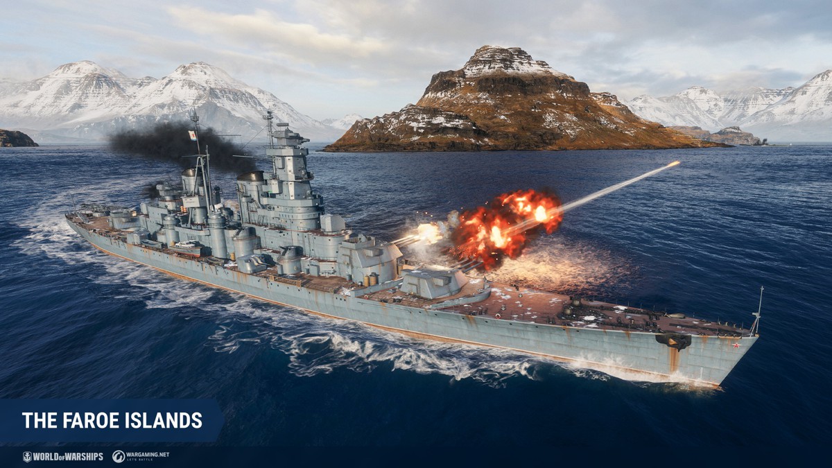
The Faroe Islands map has been designed for battles involving Tier VII–X ships, as well as superships.
It can be found in two game modes: Domination with three Key Areas and Domination with four Key Areas.
[hr]
Map Appearance
Battles will take place among flowing mountains covered with a thin layer of snow and islands with steep shores. Visually, the map is divided into two parts—the eastern part, covered with snow and ice, and the less snowy center and western part. When creating the map, we were inspired not only by the climate but also by the sights of the Faroe archipelago.
[expand style="more"]
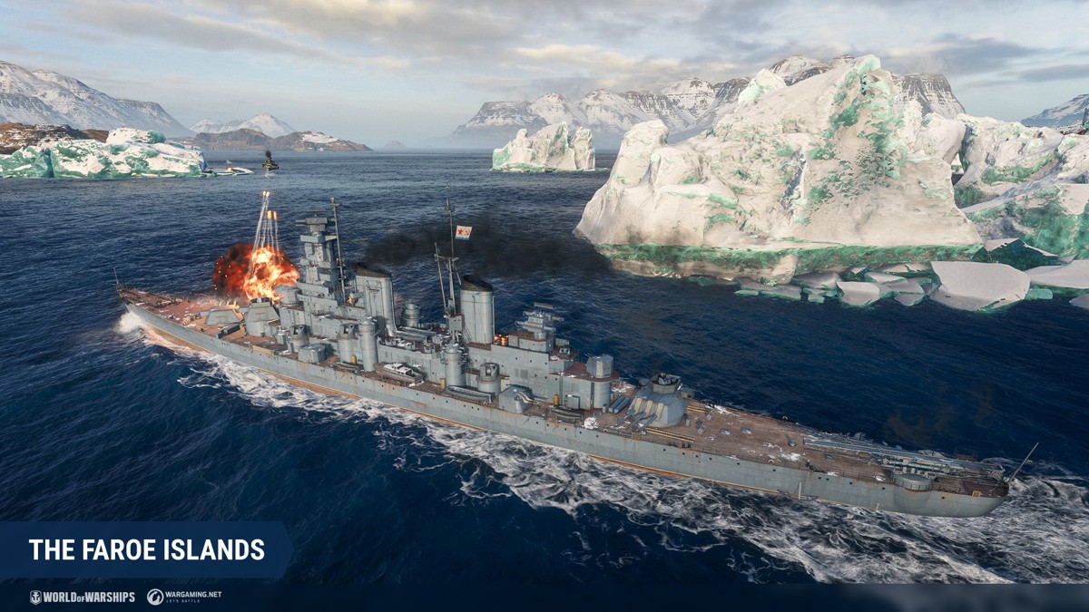
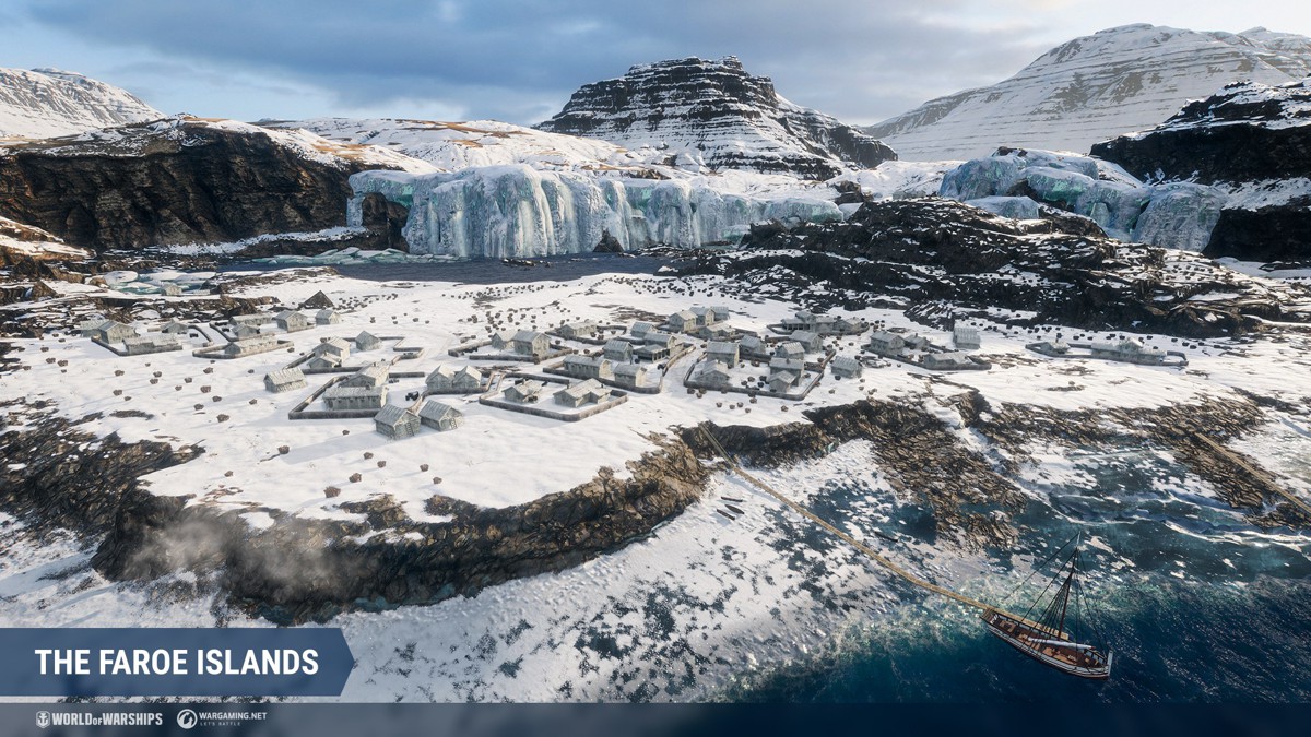
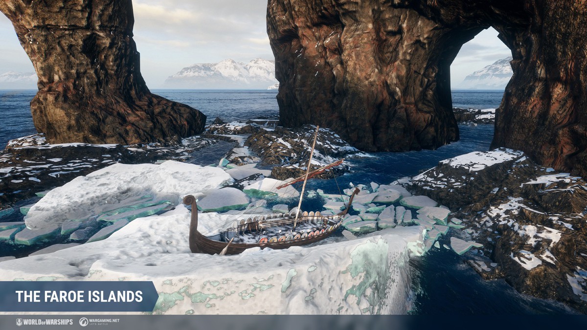
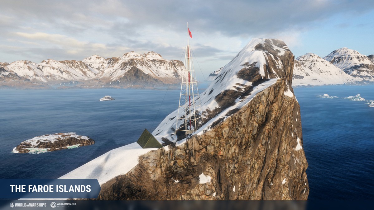
[/expand] There are many small crystal-clear icebergs in the snowy part. At the base of the mountain in the southeastern part, you can see waterfalls covered in ice and a small snow-covered settlement. Drangarnir is a large gate-shaped cliff located in the eastern part of the map. Nearby, you can see a small ship in the ice-covered waters.
[expand style="more"]
[/expand] Close to that is an island with a high wedge-shaped cliff, which resembles another attraction of the Faroe Islands—Tindhólmur. Take a closer look—you will see a small weather station on top of the cliff.
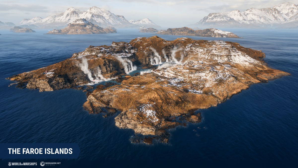
Move closer to the center and pay attention to the island with numerous geothermal sources from which steam is constantly emitted. In the northwestern part of the map, at the base of another peak, you can find a small settlement with well-groomed green fields. A football field for the town's residents to spend their leisure time is also nearby. In real life, about 20 football stadiums have been built on the territory of the Faroe Islands.
[expand style="more"]
[/expand]
In total, the map can have three types of weather: early morning, bright sunny day, and thick fog.
[expand style="more"] [/expand] [hr]
How to play
Three Key Areas
We can distinguish three main directions on the Faroe Islands map. Let's consider them on the example of Domination with three Key Areas.
Key Area A
[expand type="details"]
The first direction is an area of open water with a range of islands and protruding cape near Key Area A. This direction is a great place for duels and maneuvers for battleships and cruisers that play at long ranges because there is a fairly large area of open water nearby. However, stealthy torpedo destroyers can also successfully operate in this place. The cape serves as a shelter for destroyers and cruisers when capturing the Key Area, and the islands can cover ships from enemy fire from the opposite flank and center of the map. [/expand]
Key Area B
[expand type="details"]
The second direction —and the most notable feature of the map—is the center with Key Area B located between the four islands. This is a kind of arena with clean lines of fire for battles at close range, primarily for destroyers and cruisers that help in capturing. Gently sloping on one side and sheer on the other, the islands at the central Key Area offer an ideal cover and firing position for cruisers with high-arcing shell trajectories.
If you stay around one of the side islands, you'll have
Source